
Primary Keyword: natural weather signs
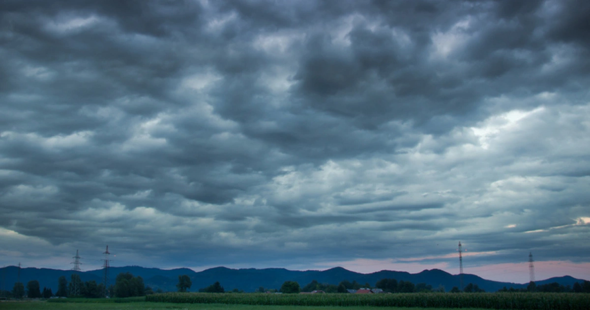
Long before weather apps and satellite forecasts existed, people relied on the sky to anticipate changing conditions. Farmers, sailors, hikers, and outdoor enthusiasts learned to recognize cloud formations, atmospheric phenomena, and subtle environmental cues that often signal approaching weather shifts.
While modern meteorology provides the most accurate forecasts, understanding natural weather signs can deepen your appreciation of the atmosphere and offer useful insights when spending time outdoors. From towering storm clouds to mysterious rings around the moon, these visual clues reveal fascinating details about what’s happening above us.
Why Learning to Read the Sky Still Matters
Observing the sky encourages a closer connection with nature and enhances outdoor awareness. Although traditional weather wisdom should never replace official forecasts during severe weather events, recognizing common atmospheric patterns can help you:
- Prepare for changing weather conditions
- Make safer decisions during outdoor activities
- Understand basic meteorological processes
- Appreciate the science behind cloud formations
- Strengthen environmental observation skills
Let’s explore six remarkable weather indicators that have been used for generations.
1. Cumulonimbus Clouds: Nature’s Storm Warning System
Among all natural weather signs, cumulonimbus clouds are perhaps the most dramatic and recognizable.
These towering clouds are associated with thunderstorms, heavy rainfall, hail, strong winds, and occasionally tornadoes.
How Cumulonimbus Clouds Develop
The formation process generally follows several stages:
Early Towering Cumulus Stage
Warm, moist air rises rapidly, creating vertically developing cloud towers.
At this stage, weather may still appear relatively calm.
Mature Storm Stage
As the cloud continues to grow, strong updrafts and downdrafts develop simultaneously.
Signs of maturity include:
- Lightning activity
- Heavy precipitation
- Thunder
- Gusty winds
Anvil Formation
The cloud top spreads outward when it reaches stable layers of the atmosphere, forming the characteristic anvil shape.
This often indicates that a thunderstorm is active or imminent.
What It Means
If you observe rapidly growing cumulonimbus clouds with an anvil-shaped top, it’s wise to seek shelter and monitor official weather updates.
2. Mammatus Clouds: A Sign of Atmospheric Turbulence
Mammatus clouds are among the most visually striking cloud formations.
Their distinctive pouch-like structures hang beneath the cloud base, creating an unusual appearance.
Are Mammatus Clouds Dangerous?
Mammatus clouds themselves do not produce severe weather directly. However, they frequently occur near strong thunderstorm systems.
They are often associated with:
- Intense atmospheric instability
- Strong turbulence aloft
- Nearby storm activity
- Mature thunderstorm systems
What It Means
Seeing mammatus clouds suggests that significant weather activity may be occurring in the surrounding area.
They should be viewed as an indicator to remain weather-aware rather than as a direct warning sign.
3. Red Sky at Morning and Red Sky at Night
The old saying, “Red sky at night, sailors’ delight; red sky in morning, sailors take warning,” remains one of the most famous examples of traditional weather wisdom.
The Science Behind Red Skies
The reddish color occurs because sunlight travels through more of Earth’s atmosphere during sunrise and sunset.
Dust particles and moisture scatter shorter blue wavelengths, allowing red and orange tones to dominate.
Red Sky at Night
In many mid-latitude regions where weather systems move west to east, a red sunset may indicate:
- Dry air to the west
- High-pressure systems approaching
- Stable weather conditions
Red Sky in the Morning
A red sunrise can sometimes suggest:
- Moisture already present in the atmosphere
- Incoming low-pressure systems
- Increased likelihood of unsettled weather
What It Means
Although not universally accurate, this traditional observation aligns surprisingly well with meteorological principles in many locations.
4. Ring Around the Moon: The Meaning of Lunar Halos
One of the most fascinating natural weather signs is the appearance of a halo surrounding the moon.
These luminous rings often spark curiosity and folklore.
What Causes a Moon Halo?
Moon halos form when moonlight passes through ice crystals suspended within high-altitude cirrus clouds.
The crystals refract light at approximately 22 degrees, creating a circular halo around the moon.
Does a Moon Halo Predict Rain?
A lunar halo often indicates that moisture-rich cirrus clouds are advancing ahead of a warm front.
In some cases, this pattern precedes precipitation within 12 to 24 hours.
However, it does not guarantee rainfall.
What It Means
A ring around the moon suggests changing atmospheric conditions and increasing moisture in the upper atmosphere.
5. Lenticular Clouds: The So-Called “UFO Clouds”
Lenticular clouds are smooth, lens-shaped formations that frequently appear over mountain ranges.
Their unusual appearance has occasionally led to mistaken reports of unidentified flying objects.
How Lenticular Clouds Form
These clouds develop when:
- Stable air flows over elevated terrain
- Atmospheric waves form on the downwind side of mountains
- Moisture condenses at wave crests
What Do They Indicate?
Lenticular clouds often signal:
- Strong winds at higher elevations
- Stable atmospheric conditions
- Mountain wave activity
Importantly, they are not typically associated with severe weather.
What It Means
For pilots and mountaineers, lenticular clouds can indicate significant turbulence aloft despite otherwise calm conditions.
6. Virga: Rain That Never Reaches the Ground
Virga refers to precipitation that evaporates before reaching Earth’s surface.
From a distance, virga appears as streaks extending downward from clouds.
How Virga Forms
Virga occurs when:
- Rain falls through dry air layers
- Evaporation exceeds precipitation rates
- Surface conditions remain relatively dry
It commonly develops beneath:
- Altostratus clouds
- Nimbostratus clouds
- High-based thunderstorms
Why Virga Matters
Virga can indicate:
- Dry atmospheric conditions below cloud level
- Potential for gusty downdraft winds
- Moisture present in upper atmospheric layers
What It Means
Although rainfall may appear imminent, the ground may receive little or no precipitation.
The Limits of Natural Weather Signs
While understanding natural weather signs can improve environmental awareness, they should not replace professional forecasts.
Weather systems are complex, and individual signs do not always predict specific outcomes.
For the safest approach:
- Monitor official weather services
- Use weather apps and radar data
- Pay attention to local advisories
- Combine traditional observations with modern forecasting tools
This balanced strategy provides the most reliable information.
Tips for Becoming Better at Sky Reading
If you’d like to improve your weather observation skills, consider these practical steps:
Keep a Weather Journal
Record cloud types, wind patterns, and subsequent weather outcomes.
Over time, you’ll notice recurring patterns.
Learn Basic Cloud Classification
Understanding common cloud families makes atmospheric observations easier.
Compare Observations with Forecasts
Use official forecasts to validate your interpretations.
This strengthens your meteorological understanding.
Prioritize Safety
Never delay seeking shelter during severe weather simply because traditional signs appear inconsistent.
Safety should always come first.
Frequently Asked Questions About Natural Weather Signs
Can clouds accurately predict the weather?
Cloud formations often provide valuable clues about atmospheric conditions, but they should be combined with official weather forecasts for accuracy.
Does a ring around the moon always mean rain is coming?
No. A moon halo often indicates increased atmospheric moisture, but precipitation is not guaranteed.
Are mammatus clouds dangerous?
Mammatus clouds themselves are not hazardous, although they commonly appear near strong storm systems.
Why is the sky red at sunset?
Red sunsets occur because sunlight travels through more atmosphere, scattering shorter wavelengths and allowing red tones to dominate.
What does virga indicate?
Virga suggests that precipitation is evaporating before reaching the ground, often reflecting dry lower atmospheric conditions.
Internal Linking Suggestions for Secretsofthegreengarden.com
Consider linking this article to related content using anchor texts such as:
- Natural Signs That Predict Rain in Your Garden
- Understanding Cloud Types Every Gardener Should Know
- How Weather Patterns Influence Plant Growth and Health
These internal links support topical authority while improving user engagement.
Recommended External Resources
For evidence-based weather information, reference these trusted organizations:
- National Weather Service – Cloud Classification and Weather Safety: https://www.weather.gov
- National Oceanic and Atmospheric Administration (NOAA): https://www.noaa.gov
- Met Office – Understanding Clouds and Weather Patterns: https://www.metoffice.gov.uk
These authoritative sources provide scientifically accurate weather education and forecasting resources.
Final Thoughts
Learning to interpret natural weather signs offers a fascinating glimpse into the science of Earth’s atmosphere. From towering cumulonimbus clouds that signal approaching storms to delicate halos around the moon that hint at changing conditions, these observations connect us to centuries of environmental knowledge.
Although modern forecasting technology remains the most dependable tool for predicting weather, understanding the sky’s visual language can enrich outdoor experiences and foster a deeper appreciation for the dynamic processes shaping our world.